
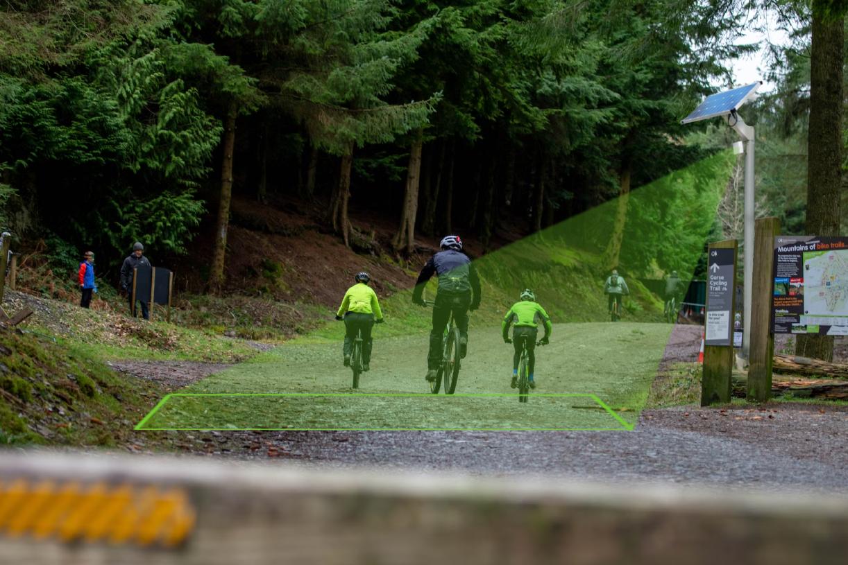
Why smarter cycling traffic monitoring matters
Across cities, regions, and rural landscapes, cycling infrastructure is gaining momentum. Councils and route managers are investing in new bike paths, upgrading existing corridors, and promoting active travel as a way to reduce emissions, improve public health, and strengthen local economies. But as networks grow, so does the need for reliable, real-time cycling traffic monitoring to understand how these routes are actually being used.
Traditionally, many path usage insights have come from manual counts or short-term surveys. While useful, these snapshots are often too limited to guide long-term planning decisions. They rarely capture daily, seasonal, or weather-driven patterns – and they can’t easily be integrated into broader asset management or environmental datasets. The result is that decision-makers are often left to rely on assumptions rather than evidence.
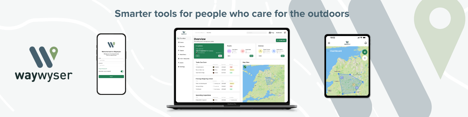
This is where modern IoT sensors and tools like Waywyser make a meaningful difference.
By combining automated bike counters with a spatial platform that understands assets, environment, and community context, planners can see not just how many people are using a path – but when, where, and why those patterns emerge. This shift toward continuous, high-quality data helps support more informed investment, better maintenance, and more resilient, sustainable cycling networks.
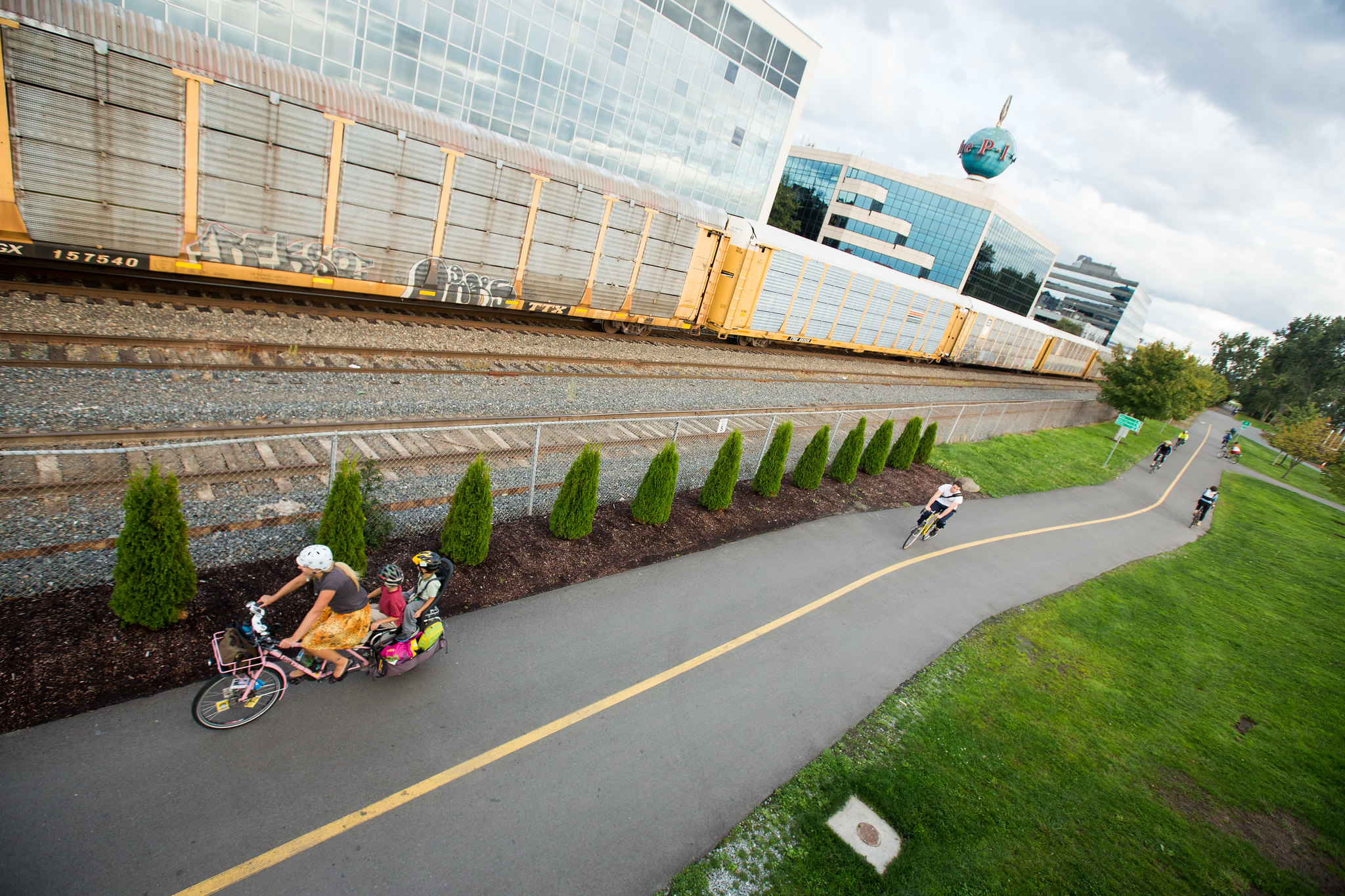
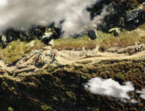
A purpose-built cycling path in Seattle, following the railway line. Credit: Adam Coppola Photography
Waywyser’s role is to make that cycling traffic monitoring data easy to visualise, interpret, and share. Whether a team is assessing the value of a new bike corridor, responding to maintenance pressures, or preparing a funding application, integrated path usage data becomes a powerful tool for everyday decision-making.
The types of IoT sensors used in cycling traffic monitoring
Understanding how people move on a path or cycling network starts with selecting the right sensors. Different technologies capture different insights, and each comes with its own strengths depending on the environment, surface type, and the level of detail required. Below is a clear overview of the most common sensor types used in cycling traffic monitoring and path usage.
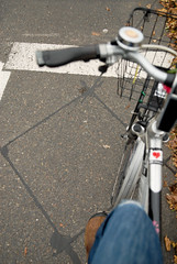
Passive Infrared (PIR) Sensors
-
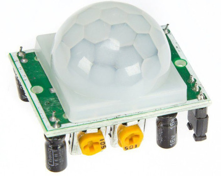
- PIR Sensor
-
- PIR Sensor discreetly placed in a post along a cycle path
How they work:
PIR sensors detect changes in heat signatures – specifically, the movement of warm bodies passing through a field of view. They’re typically mounted on posts or small enclosures alongside a path.
Why they’re useful:
Excellent for mixed-use paths where pedestrians and cyclists share space.
Low-cost and low-maintenance.
Well suited for natural-surface and remote paths where installation needs to be unobtrusive.
Limitations:
PIR sensors can’t distinguish between different modes (cyclists vs. walkers) on their own, and they don’t capture travel direction without dual-sensor setups.
Radar Sensors
How they work:
Radar-based counters emit microwave or Doppler signals and measure how they bounce back from moving objects. This allows them to detect movement, estimate speed, and distinguish direction.
Why they’re useful:
Highly reliable in all weather conditions – rain, snow, fog, or heat.
Capable of differentiating cyclists from pedestrians based on speed and movement patterns.
Ideal for busier corridors or commuting routes where detailed flow analysis matters.
Limitations:
They may require careful calibration in areas with complex backgrounds or multiple objects moving simultaneously.
Inductive Loop Sensors
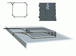
How they work:
Inductive loops are installed beneath the path surface and detect changes in electromagnetic fields when bicycles pass over them. The metal components of a bike trigger the loop directly.
Why they’re useful:
Extremely accurate for counting bicycles specifically.
Great for permanent installations on paved paths or protected cycling lanes.
Able to track directional flow when loops are installed in pairs.
Limitations:
Installation is more involved and not ideal for unpaved or natural-surface paths. Loops also can’t detect pedestrians, making them mode-specific.
Additional sensor types that complement cycling traffic monitoring
While PIR, radar, and loops are the core technologies for counting cyclists, other IoT devices can add valuable contextual data:
Bluetooth / Wi-Fi Probe Sensors
Detect anonymized device signals to estimate travel times and repeat visitation.
Useful for understanding longer-distance cycling movements across a network.
Environmental Sensors
Weather stations, soil moisture probes, and flood sensors help correlate cycling traffic monitoring with environmental conditions.
Particularly helpful for climate adaptation planning or managing routes in sensitive ecosystems.
Camera-Based Counting Systems (Privacy-Preserving)
Use AI to classify modes and count users.
Most modern systems process imagery locally, storing only anonymised data.
These sensor types each offer different strengths, and choosing the right mix can dramatically improve the quality of cycling traffic monitoring data. When integrated with Waywyser, their insights gain spatial context – transforming raw counts into meaningful planning intelligence.
How sensor data integrates with Waywyser
Collecting cycling traffic monitoring data is only half the challenge – making sense of it is where real value emerges. Waywyser is designed to take the streams of information generated by IoT sensors and place them into a meaningful spatial and asset-based context, so teams can move from raw numbers to actionable insight.
Simple connections through feeds, APIs, or scheduled imports
Waywyser supports a variety of ways to bring in data from PIR sensors, radar units, inductive loops, and complementary IoT devices.
This can include:
Live data feeds for real-time cycling traffic monitoring
API connections for structured, automated imports
Scheduled file uploads (e.g., CSV, JSON) for organisations using periodic counter downloads
The goal is to ensure flexibility – so whether a route manager has one sensor or a full network of counters, integration remains straightforward.
Visualising sensor data on maps and dashboards
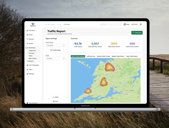
Once sensor data is connected, Waywyser turns it into intuitive visual layers:
Mapped sensor locations with real-time or historic usage values
Heat maps to highlight high-demand corridors
Time-series charts to reveal daily, weekly, or seasonal patterns
Mode-specific summaries, where available (e.g., cyclists vs pedestrians)
This allows planners to quickly compare usage across different routes, identify emerging patterns, and understand how infrastructure is performing over time.
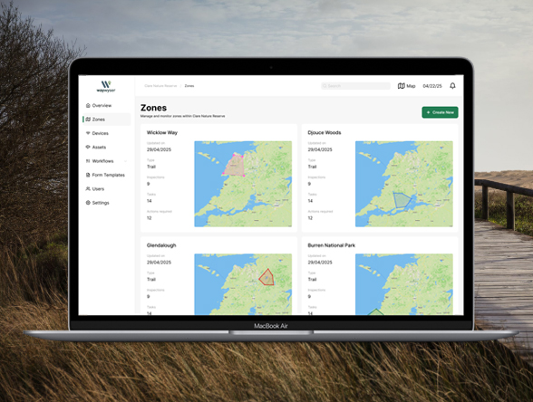
Linking cycling traffic monitoring data with assets and maintenance activities
One of Waywyser’s strengths is tying sensor data directly to assets and maintenance records. For example:
High-traffic segments can be linked to surface condition records or upcoming maintenance tasks
Usage trends can inform resurfacing schedules, signage upgrades, or vegetation management
Teams can spot discrepancies (e.g., a sudden drop in counts indicating a sensor fault or route obstruction)
This creates a connected picture of how paths are used and how they’re holding up – without needing separate systems.
Bringing in environmental and community context
Path usage rarely exists in isolation. Waywyser allows sensor data to be overlaid with:
Environmental layers such as flood zones, soils, or biodiversity areas
Land use information to see how routes interact with surrounding communities
Equity and accessibility indicators, where available
With these spatial layers, path usage becomes more than a number – it becomes insight into how people move through places, and how those movements intersect with ecology, land management, and local investment priorities.
Making insights accessible across teams
Waywyser is built for collaboration. Sensor data, maps, and summaries can be shared easily across:
Planning teams
GIS and asset managers
Environmental officers
Community engagement teams
Executive and elected decision-makers
This ensures cycling traffic monitoring data is not trapped in technical silos. Instead, it becomes part of everyday decision-making – helping organisations communicate clearly, justify investments, and plan for future growth.
Key benefits for cycling infrastructure planning
Integrating IoT sensor data with Waywyser gives planners, route managers, and environmental teams a clearer picture of how cycling infrastructure is performing. The result is more confident decision-making, more transparent investment, and a better experience for communities using the network.
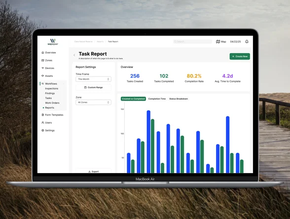
Better maintenance decisions
Usage patterns help identify which route sections experience the greatest wear and tear. By linking sensor data with asset condition records in Waywyser, maintenance teams can:
Prioritise resurfacing or grading where it will have the most impact
Schedule routine work more efficiently
Detect issues early – such as declining usage due to obstructions or damage
This shifts maintenance from reactive to proactive, saving time, budget, and resources.
Stronger evidence for funding and investment
Quantified cycling traffic monitoring is a powerful asset when seeking grants or justifying upgrades. Sensor data integrated into Waywyser creates:
Clear visualisations that support business cases
Demonstrable evidence of demand and community benefit
Insight into trends that future-proof investment decisions
Funding bodies increasingly look for measurable outcomes, and integrated cycling traffic monitoring data provides exactly that.
Improved safety and user experience
Understanding when and how cyclists use a path helps teams design safer, more enjoyable routes. With sensor data, organisations can identify:
Peak times and potential congestion points
Sections where speeds are high or conflict is likely
Opportunities for improved lighting, signage, or surfacing
Waywyser makes it easy to spot these patterns and translate them into practical enhancements.
Supporting equitable and sustainable planning
Cycling networks serve diverse communities, and usage data helps ensure they serve them fairly. When paired with spatial layers in Waywyser, sensor insights can highlight:
Underserved areas with growing or unmet demand
How usage intersects with environmental sensitivities
Opportunities to align cycling networks with climate resilience goals
This supports planning that is both people-centred and environmentally responsible.
The Bigger Picture: IoT + Waywyser across cycling networks
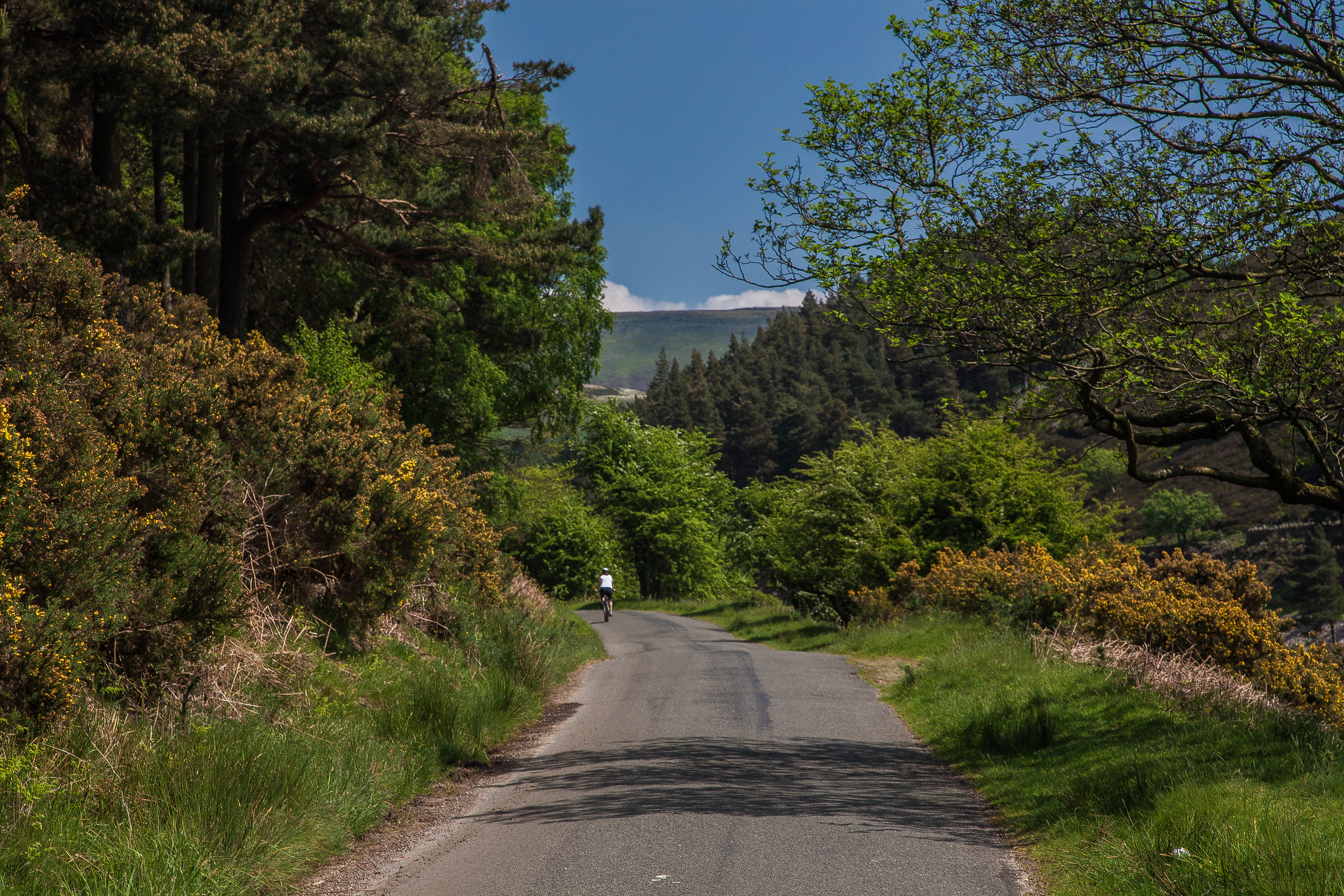
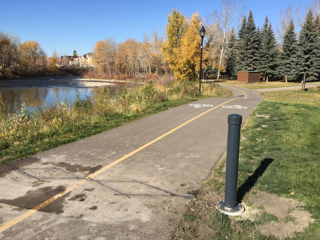
Cyclist on the Howden Reservoir bike path. Credit: Peter Rintels
While cycling infrastructure is a natural starting point for sensor integration, the benefits extend far beyond bike paths. Cycling networks are rarely single-purpose. They weave through parks, natural areas, town centres, and regional corridors – often supporting a blend of recreation, transport, conservation, and community wellbeing.
Pairing IoT sensors with Waywyser gives managers a unified way to understand usage and environmental conditions across all these spaces, allowing for more holistic planning and management.
Walking and shared-use paths (Greenways)
Pedestrian activity often follows different patterns than cycling, and understanding these nuances helps ensure paths are accessible, safe, and well maintained. PIR, radar, and camera-based systems can all capture foot traffic, and Waywyser provides a central place to visualise this alongside cycling data.
This supports decisions such as how to balance shared-use space, whether widening is needed, or how seasonal changes affect different user groups.
Nature-based cycling paths and conservation areas
Sensors – paired with environmental data – can help manage visitor pressure in sensitive natural spaces. When usage spikes coincide with habitat values or soil vulnerability, Waywyser can highlight where:
Erosion risks are increasing
Cycling path rerouting may be needed
Visitor education or signage could reduce impact
This enables recreation planning that protects biodiversity while still supporting community access.
A unified view for planning, management, and stewardship
Across all these contexts, the value remains consistent: a single platform where usage, assets, and environmental conditions can be understood together. IoT sensors provide the raw insights, and Waywyser transforms them into actionable intelligence for:
Path management
Asset lifecycle planning
Environmental stewardship
Funding and investment decisions
Community engagement
This big-picture perspective helps organisations plan Cylcing networks that are resilient, inclusive, and adaptable to changing demands.
In summary
Cycling paths and active mobility networks are becoming essential components of modern, sustainable transport systems. But to plan, manage, and justify these networks effectively, organisations need more than assumptions – they need clear, reliable cycling traffic monitoring.
By integrating IoT sensors with Waywyser, route managers and planners gain a powerful, accessible way to understand how people are really using their infrastructure. PIR, radar, and inductive loop sensors provide accurate, continuous counts, while Waywyser brings everything into a spatial context that connects usage with assets, maintenance needs, environmental conditions, and community outcomes.
The result is a more informed approach to route planning – one where decisions about maintenance, funding, safety, and sustainability are grounded in evidence, not guesswork.
Whether you’re managing a regional cycling corridor, upgrading urban commuter paths, or balancing recreation with environmental protection, IoT-enabled insights within Waywyser help ensure every investment delivers value. They empower teams to create networks that are resilient, equitable, and aligned with local priorities.
As cycling and active travel continue to grow, now is the time to embrace the tools that make route management smarter, more transparent, and future-ready. Waywyser is here to help turn data into decisions, and decisions into better places for people and nature.