Biodiversity

Biodiversity underpins the health of our ecosystems, economies, and communities. It ensures resilient landscapes, supports food security, and sustains the natural systems that people rely on every day. Protecting biodiversity is not only an environmental priority but also a social and economic necessity, strengthening climate resilience, public health, and sustainable development.

WayWyser can be used to manage species, populations and invasive species, to ensure biodiversity

Yet, safeguarding biodiversity takes more than good intentions—it requires accurate data, informed decision-making, and collaborative action. To achieve this, communities, NGOs, and governments need tools that make biodiversity protection more visible, trackable, and manageable. Waywyser brings these elements together in a digital platform that ensures species, habitats, and ecosystems are mapped, monitored, and managed for long-term community and environmental value.
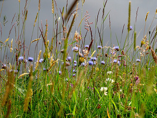
Key Biodiversity Solutions that Waywyser Helps to Manage

  • Habitat Mapping & Monitoring (forests, wetlands, grasslands, coastal ecosystems).

  • Species Protection (tracking endangered or invasive species).

  • Conservation Planning (wildlife corridors, protected area management).

  • Restoration Projects (reforestation, pollinator pathways, peatland recovery).

  • Urban Biodiversity (green roofs, pollinator gardens, nature-inclusive design).

  • Nature-Based Solutions (climate adaptation through ecosystem services).

WayWyser

Track every activity, close tasks sooner

Funding Opportunities  

Farmers and land managers can access a wide range of funding opportunities—from EU agri-environment schemes (CAP), to national sustainability programmes, carbon farming initiatives, and biodiversity grants. These schemes often require strong data collection and compliance reporting. Waywyser strengthens applications by offering robust monitoring, mapping, and reporting tools, making it easier to demonstrate impact. With Waywyser, you can secure funding and deliver agriculture that is productive, profitable, and sustainable.

Waywyser Features in the Context of Biodiversity

Mobile GIS Reporting

Record biodiversity observations directly in the field. From species sightings to habitat conditions, mobile GIS reporting ensures data is captured quickly and accurately.

Geo-located Finding Submission

All biodiversity findings are tied to precise map coordinates, creating spatial datasets that help track species movement, invasive threats, or sensitive habitats.

Task Creation and Escalation

Findings such as invasive species outbreaks or habitat degradation can be turned into tasks for field teams, with escalation options to ensure urgent issues are prioritised.

Custom Form Building

Create tailored forms for species surveys, habitat assessments, or community reporting, making biodiversity data collection fit for purpose across different ecosystems.

Third-Party Integration

Integrate with platforms like GBIF, ESRI, or local conservation databases to streamline biodiversity data sharing and enhance existing workflows.

Asset Management

Track biodiversity-related assets, such as monitoring stations, nesting boxes, or restoration equipment, ensuring they are maintained for long-term use.

Traffic Monitoring

Monitor human activity within sensitive habitats. Traffic data helps balance public access with conservation, reducing pressure on vulnerable species.

Preventative Maintenance

Use predictive insights to schedule conservation actions (e.g., habitat restoration before degradation accelerates) to reduce costs and improve outcomes.

Offline Maps

Support biodiversity monitoring in remote or protected areas without network coverage. Data syncs once back online, ensuring no findings are lost.

Custom Overlays

Overlay biodiversity zones, habitat maps, or species ranges on base maps, enabling decision-makers to visualise conservation priorities alongside development pressures.

Mobile GIS App & Management System - WayWyser Platform

Let us help you achieve your monitoring and management goals.

Contact us using the web form, or email us at info@evolvetech.ie
Thank you for your enquiry.
There was an error trying to send your message. Please try again later.

By submitting this form I authorise the use of my personal data by WayWyser. View our Privacy Policy

Mobile GIS App & Management System - WayWyser Platform

We’ve already successfully trialled WayWyser with 12 out of 13 rural recreation officers in Ireland who are rolling it out on their trails.
Mobile GIS App & Management System - WayWyser Platform

Landowners in the MacGillycuddy Reeks EIP agri-environmental project are surveying walkers with WayWyser.

Mobile GIS App & Management System - WayWyser Platform

Forum Connemara EIP is using WayWyser to monitor and record invasive species.