Heritage Sites

whether cultural landmarks, archaeological sites, or historic landscapes – connect communities to their history and identity. They drive tourism and economic growth, foster community pride and education, and act as living records of our collective past.

Preserving these places is vital not only for cultural continuity but also for sustainable development, as they shape the social fabric and attract global recognition.

Safeguarding heritage sites, however, is complex. It requires accurate data, strong planning, and collaboration across sectors. To achieve long-term protection, communities, NGOs, and governments need tools that make heritage management more transparent, accessible, and sustainable. Waywyser brings these elements together in a digital platform that ensures heritage assets are mapped, monitored, and managed for generations to come. 

Busy trail on public holiday

Key Heritage Solutions that Waywyser Helps to Manage

  • Cultural Landmark Mapping & Monitoring (monuments, archaeological sites, historic structures).

  • Conservation & Restoration Projects (buildings, artefacts, landscapes).

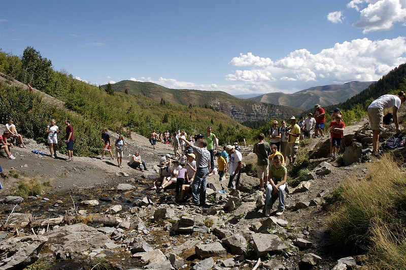
  • Visitor Management (balancing tourism with preservation).

  • Community Engagement (oral histories, local knowledge integration).

  • Adaptive Reuse Planning (repurposing historic sites for modern use while retaining cultural value).

  • Risk & Resilience Planning (protecting sites from climate change, erosion, or overuse).

WayWyser

Track every activity, close tasks sooner

Funding Opportunities  

There are significant funding opportunities for heritage protection – from UNESCO cultural heritage grants and EU heritage programmes, to national conservation funds and philanthropic foundations. The key is to demonstrate how heritage projects provide measurable cultural, economic, and community benefits. Waywyser strengthens funding applications by offering the data, reporting, and planning tools needed to meet funder requirements. With Waywyser, heritage organisations can secure funding and ensure that cultural treasures are preserved for future generations.

Using Waywyser to manage Heritage Sites

Mobile GIS Reporting

Capture field data directly from heritage sites – such as structural damage, erosion, or visitor impacts – ensuring timely and accurate updates.

Geo-located Finding Submission

Every report is tied to a specific location, building a precise record of heritage assets and allowing managers to track changes over time.

Task Creation and Escalation

 Findings like urgent repairs or conservation needs can be escalated into actionable tasks for field teams, ensuring swift response and accountability.

Custom Form Building

 Create digital forms tailored to heritage management, such as site inspections, cultural inventories, or visitor feedback surveys, without technical expertise.

Third-Party Integration

 Integrate seamlessly with heritage databases, GIS platforms, and tourism systems to align conservation data with planning and promotion efforts.

Asset Management

Maintain an inventory of heritage-related assets—from historic buildings and artefacts to interpretive signage and facilities—tracking their condition and life cycle.

Traffic Monitoring

 Monitor visitor flows to prevent overuse, protect fragile sites, and balance tourism with conservation goals.

Preventative Maintenance

 Plan scheduled inspections and maintenance, reducing costly restorations and ensuring sites remain safe and accessible.

Offline Maps

Support site management in remote locations without reliable connectivity. Field teams can record findings offline, syncing once they reconnect.

Custom Overlays

Layer historic boundaries, protected zones, or archaeological surveys on maps, helping stakeholders visualise threats and plan protective measures.

Mobile GIS App & Management System - WayWyser Platform

Let us help you achieve your monitoring and management goals.

Contact us using the web form, or email us at info@evolvetech.ie

Thank you for your enquiry.
There was an error trying to send your message. Please try again later.

By submitting this form I authorise the use of my personal data by WayWyser. View our Privacy Policy

Mobile GIS App & Management System - WayWyser Platform

We’ve already successfully trialled WayWyser with 12 out of 13 rural recreation officers in Ireland who are rolling it out on their trails.

Mobile GIS App & Management System - WayWyser Platform

Landowners in the MacGillycuddy Reeks EIP agri-environmental project are surveying walkers with WayWyser.

Mobile GIS App & Management System - WayWyser Platform

Forum Connemara EIP is using WayWyser to monitor and record invasive species.